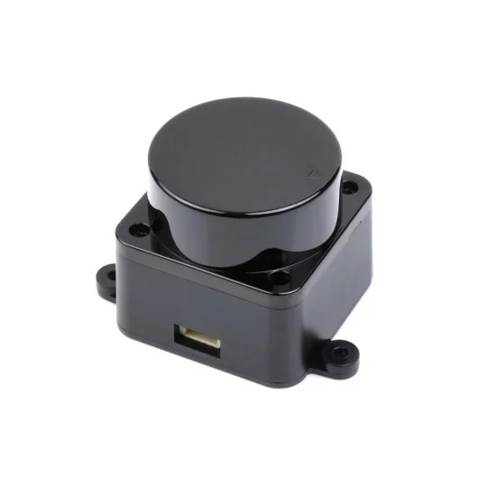
- All products
- Sensors & Modules
- LIDAR
- LIDAR D300 DTOF Laser Ranging Sensor Developer Kit
- LIDAR
Features
- TOF Laser Ranging : Utilizes Time of Flight (TOF) laser ranging technology to ensure accurate distance measurements.
- UART Communication Support : Features UART communication support for easy data transfer.
- Measuring Range : Offers an impressive measuring radius of up to 12 meters, making it suitable for various scenarios.
- Anti-Glare Interference : Boasts a 30,000 Lux anti-glare interference capability, ensuring reliable performance even in challenging lighting conditions.
- High Measurement Frequency : Achieves a measurement frequency of 4500Hz, enabling rapid data acquisition.
- 360° Scanning Range : Provides a full 360° scanning range for comprehensive data collection.
- Laser Safety : Complies with FDA Class 1 Standards for laser safety, ensuring user protection.
- Compact Design : Features a compact and ergonomic appearance, making it easy to integrate into different systems.
- Extended Service Life : Offers a remarkable service life of over 10,000 hours, guaranteeing long-term reliability.
Specifications
- Measuring Range : 0.02~12m (Typical)
- Sampling Frequency : 4500 Hz
- Sweep Frequency : 10 Hz
- Angular Resolution : ≤1°
- Mechanical Size : 38.59 x 38.59 x 33.50mm
- Communication Interface : UART @ 230,400bps
- Supply Voltage : 5V
- Working Current : 180mA
- Power Consumption : 0.9W
- Operating Temperature Range : -10°C to 40°C
- Scanning Range : 360°
- Ranging Accuracy : 10mm (300mm < measurement distance ≤ 12,000mm)
Applications
- Education and Research : Ideal for educational and research purposes, facilitating various experiments and studies.
- Robot Obstacle Avoidance : Enables robots to navigate and avoid obstacles with precision.
- Measurement and Inspection : Supports accurate measurements and inspections in diverse industries.
- Smart Gesture Control : Utilizes 2D gesture recognition for intuitive and interactive control.
- Autonomous Navigation : Essential for autonomous systems, ensuring safe and reliable navigation.
- Map Reconstruction : Aids in creating detailed maps for various mapping and geospatial applications.
- Navigation and Positioning : Assists in precise navigation and positioning tasks across multiple domains.